Introduction
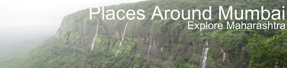
Mumbai ,formerly known as Bombay, is the capital of the Indian state of Maharashtra. With an estimated population of 20.5 million, it is the largest metropolis in India and one of the most populous cities in the world. The Mumbai Metropolitan Area which includes cities of Navi Mumbai & Thane, is also the world's 5th most populated metropolitan area.
There are so many Places around Mumbai to see . Which include Temples, Historical Places, Hill station, Wild Life and Waterfalls etc.
This site help to find out known-unknown places around Mumbai. which can be one or two day picnic for People and children's who don't have time.
Then What you are Thinking Lets Plan to see Nature..
Kohoj is located about 104 km from Mumbai off the Mumbai - Ahmedabad Highway. Upon reaching Manor you have to take a right turn under a newly built flyover and take the Manor - Wada road
Brief Introduction about Kohoj
Fort: -
Height: ~ 3200 feet
Grade: Medium
Time: ~ Maximum 2.5 hrs from Waghote, Base Village
Location: Palghar region
History:-
Very few of the historical evidences are coherent to this fort. Looking at its well-dug cisterns, the fort can be said to be belonging to Bhoj-period. But no such evidences are available. In 16th century, Portuguese captured this fort from the King of Gujarat. They constructed fortifications and bastions on this fort. Later, in 18th century, Peshwe conquered this fort in their campaign of 1737. Afterwards the fort remained under the British rule.
How to reach :
There are many way to reach Kohoj fort
1) From Kalyan bus depot one has to reach Wada.
From here we can alight in a bus going towards Palghar or Manor
and board at Vaghote village.
One can also hire six-seater rickshaws from Wada.
Now keeping the fort on our right hand side we have to walk down the foot-track.
After a 5 minutes of walk we have to take a right turn.
Few minutes of further walk takes us to a beautiful dam wherein
we get a wonderful reflection of the fort.
On crossing this dam actual climb of the fort begins.
There is a complete U traverse to get to the fort-top.
About 2 hours are required from Vaghote village to climb up the fort.
2) From Thane bus stop --> catch manor bus and get down at Vaghote village.
3) From palghar --> catch manor bus and get down at Vaghote village.
Fort Height : 4450 feet
Type : Hill forts
Fort Range : Selbari-Dolbari
District : Nashik
Grade : Medium
Nothing much is written in the history about this fort, as no major battle was fought here. This fort can be seen from the village of Mulher - Fort Mulher in the front, Moragad on the left and Hargad to the right. This fort is at a higher elevation than the fort of Mulher.
The top of this fort is so wide, that it can almost be called a plateau. There are some remnants of the fortification on the top. Ruins of a temple, of the residential structures and a couple of water cisterns can be seen here. However, the water in these tanks is not potable and hence it is necessary to carry enough quantity of water.
A cave with a temple of goddess Kapaar Bhavani can also be found on the plateau during the fort-walk. Apart from these places there isn't much to be seen on the fort. One can either return by the same path to visit the Mulher fort or go back to the village of Mulher. The whole walk on the fort can be completed in an hours time.
Ways To Reach :
Presently there exists only a single way to reach the fort-top. This path traverses through the village of Mulher. After leaving the village we reach a tar-road. A walk of about 20 minutes along this road brings us to a bifurcation. The way to the right, passing by a banyan tree, leads to a shepherds' colony on a hillock. At this point one has to turn towards right and reach the pass between fort Mulher and fort Hargad. This can be arrived in about an hour and half. From this pass, the way on the left takes to the fort of Mulher and the one on right to the Hargad. The trail leading to fort Hargad is not much in use and hence is not distinctly visible. An hour's time is sufficient to reach the fort-top from the pass.
Fort Height : 4200 ft.
Type : Hill forts
Fort Range : Trimbakeshwar
District : Nashik
Grade : Easy
The fort of Anjaneri, being the birthplace of lord ‘Hanuman’, has a great historical importance. Lord Hanuman was the son of ‘Pavan’ (the wind) and ‘Anjani’, and hence the fort is called as ‘Anjaneri’. Anjaneri is one of the important forts in the ranges of Tryambakeshwar near Nasik. The Nasik-Tryambakeshwar road is branched at a distance of 20 km from Nasik as ‘Anjaneri Phata’.
Fascinating Spots :
On the way from Anjaneri village to the fort some carvings can be seen in the caves near the steps. These caves have been carved out people from Jain religion.The temple is quite big. It is a proper place to accommodate on the fort. At a certain distance from this temple two different ways can be seen. The way to left hand side takes us directly to ‘Seeta cave’ within 10 minutes. This cave is made up of two rooms. 10 to 12 people can stay here comfortably. There are many carvings inside the cave.
Another way takes us directly to citadel, where one more temple of ‘Anjani Mata’ can be seen. It takes 20 minutes to reach this temple. This temple is also quite big. The perimeter of the fort is very large.
Ways To Reach :
The primary way to reach the Anjaneri fort is from Anjaneri village. One should get down at Anjaneri Phata, which is 20 km away from Nasik on the Nasik-Tryambakeshwar road. Anjaneri village is at a walking distance of 10 to 15 minutes from Anjaneri Phata. Two pinnacles called ‘Navara’ and ‘Navari’ can be seen from Anjaneri village. The way to fort goes through Anjaneri village itself. Next to that there are some steps, through which we reach the plateau of Anjaneri. It takes almost one and the half hour to reach this plateau from Anjaneri village.
Fort Height : 3500 ft.
Type : Hill forts
Fort Range : Trimbakeshwar
District : Nashik
Grade : Medium
Bhaskargad or Basgad is a part of Trimbak range, near to the famous “Trimbakeshwar”, one of the 12 “Jyotirlingas” in India. This is 43 km east of Nashik, and was built to guard the ancient Gonda pass which was a trade route from the west coast towards Nashik.
History :
History of Bhaskargad is not available. However, the rock cut steps along the mountain face and the stone cut covered cisterns are characteristics of forts built during the rule Satvaahan dynasty and indicate that the fort is ancient.
During 1271 to 1308 this fort was under the control of Yadavas of Devgiri. When Devgiri was taken over by Bahamanis, this fort went under their control. When Shahaji Maharaj revolted against Nizamshahi in 1629, the fort went under his control. In 1633, the Moghuls gained control over Bhaskargad. In 1670, Moropant Pingle won this fort for Shivaji Maharaj and the Moghuls regained it in 1688. In 1730, the fishermen rebelled with Mughals and captured the fort. Later it was with Peshwas till the British captured it in 1818.
Fascinating Spots :
The forts in this region are built on characteristically shaped mountains. The mountain of Bhaskar gad comprises mainly of basalt rock. The steps are cut through the mountain rock and take us through the stone walls towards the main entrance, which is buried under soil now. We have to enter by crawling. Once we reach the cap of the mountain, we can roam about the edge of the fort. We can find some remnants of houses and cisterns on the fort top.
Ways To Reach :
The base village of this fort is Nirgudpada, which is 20 km away from Trimbakeshwar. From Nirgudpada, the forts Harihar and Bhaskargad are visible, and Bhaskargad is to the left side of the village. We need to cross a rivulet to reach the trail to the fort, which takes us to the steps after a hike for an hour and half.
There are two routes to reach Nirgudpada:
From Nashik :
Nirgudpada is about 50 km to the east of Nashik on SH27, on the road to Trimbakeshwar.
From Khodala :
People travelling from Mumbai, Thane and Dombivli can reach Nirgudpada via 2 routes
Kalyan – Kasara – Khodala – Nirgudpada
Kalyan – Bhiwandi – Wada – Khodala – Nirgudpada
If we are traveling at odd hours on this route, better to have a private vehicle as buses might not be frequent. Also, this is a very lonely route for night traveling.
Type : Hill forts
Fort Range : Trimbakeshwar
Fort Height : 3500 feet
District : Nashik
Grade : Medium
Alike Pune district, there are many forts lying in Nasik district too. Ranges like Selbari – Dolbari, Ajanta – Satmal, Trimbak have their origin in this district. The fort of Harihar, lying on Trimbak range, was of significant importance in earlier periods, as there used to be a route crossing this range connecting Maharashtra to Gujarat.
Trimbak range has spreaded its arms to the north of Igatpuri and west of Nasik. It is divided mainly in two parts, with forts of Basgad, Utvad, hill of Fani, Harihar and Trimbakgad on one part while the forts of Anjaneri and Hargad on the other. Vaitarna is the main river in this region. But due to the one – sided slope of Sahyadri, the water flows away from this region. There is an absolute shortage of water from January to March in this region.
The fort appears to be rectangular in shape from its base village.
While climbing the fort, we come across a rock-sheet, which has got steps carved in it. Also many grooves have been carved here for additional support. After climbing these steps, we get upto the entrance door. There is a cavern ahead of this door. Again we come across few steps after a short distance walk from this cavern. On climbing these steps we reach to the main entrance door of this fort. The fort has got a tapering plateau with a raised level in the middle.
One secret – door is located at the edge of this fort, but the way to this door has now got blocked. There is a small temple of Lord Hanumana and Lord Shiva on the plateau. A small pond is there in front of this temple. Water from this pond can be used for drinking. Making headway from here we come across a palace having two rooms in it. 10 to 12 persons can be accommodated in this palace. There are five cisterns along one side of the palace, one of which has water suitable for drinking.

Ways To Reach :
Via Igatpuri – Trimbakeshwar – Khodala :
Ahead of Nirgudpada lies the village of Kasurli. One can alight here by boarding the bus of Igatpuri – Trimbakeshwar – Khodala. From this village one has to climb a small hill where Harshewadi is located. From Harshewadi the way to the fort is easy and can be climbed within an hour.
Via Kasara or Nasik :
One has reach Igatpuri via Kasara or Nasik. From Igatpuri board in a bus for Trimbakeshwar and alight at Nirgudpada, the base village of Harihar. From here a route leads us upto the rock-sheet from where the steps begin. One can reach the fort-top within about two hours via this route.
Time To Reach :
Approximately 2 hours via Nirgudpada.
About 1 hour via Harshewadi.
Kashmir Great Lakes - flowers snaps
Kashmir --> sonamarg -- >Shekdur---> Nichnai-->Gadsar-->Satsar--->Gangabal--->Naranag